
Connecticut ZIP Families and Coverage
Connecticut's USPS geography is grouped here by the three-digit families from 060xx through 069xx. The table names example towns, villages and post offices represented in each family; it does not list every five-digit code or define an exact delivery boundary. Some families mix standard delivery with PO-box or unique institutional codes. Check the street address with USPS before using a postal place name to choose a town record office.
| ZIP | Areas Covered | Post Office | Notes |
|---|---|---|---|
| 060xx | Central Connecticut, the Hartford area, Farmington Valley and northern towns | Avon, Bristol, Enfield, Hartford, Winsted, Windsor Locks | Standard, PO-box and unique codes; some cross towns. |
| 061xx | Hartford and nearby East Hartford, West Hartford, Wethersfield and Newington, plus institutional delivery | Hartford, East Hartford, West Hartford | Many are government, institutional or PO-box delivery. |
| 062xx | Northeast Connecticut, including rural towns and village offices | Danielson, Mansfield/Storrs, Putnam, North Grosvenordale | Village and town names can differ. |
| 063xx | Eastern and coastal towns from New London and Norwich toward the Rhode Island line | New London, Norwich, Groton, Niantic, Pawcatuck | Delivery names may cross town lines. |
| 064xx | Central and shoreline communities from Meriden and Middletown toward Milford | Meriden, Middletown, Milford, Old Saybrook, Wallingford | Postal city may differ from municipality. |
| 065xx | New Haven and nearby East Haven, Hamden, North Haven and West Haven areas | New Haven and institutional or PO-box delivery | Postal name does not prove city limits. |
| 066xx | Bridgeport and nearby Fairfield and Stratford delivery areas | Bridgeport, Black Rock and institutional Bridgeport routes | Postal city and town can differ. |
| 067xx | Waterbury, Litchfield towns and northwest village offices | Waterbury, Torrington, Thomaston, New Milford, Canaan | Includes village and PO-box codes. |
| 068xx | Southwestern towns and coastal communities | Danbury, Fairfield, Greenwich/Cos Cob, Norwalk, Stamford, Westport | May cross towns or use a neighboring city. |
| 069xx | Stamford and Stamford-associated delivery | Stamford, including PO-box and unique delivery | Includes non-residential delivery codes. |
The complete five-digit post-office list is maintained separately; this grouped table is an orientation aid, not a complete five-digit directory. The Connecticut Secretary of the State's post-office and ZIP listing is a statewide reference, and USPS is the live address check. A PO-box or institutional code can name a delivery point without covering nearby streets.
Connecticut ZIP Code Search Steps
Postal geography can help narrow where to look, but Connecticut's official records are kept by different offices. The statewide OPM Parcel/CAMA collection has mailing city, state and ZIP fields alongside town and parcel data; it is not a guaranteed statewide owner-name search. Some local assessors accept a ZIP filter, while town clerk indexes are town-based and registrars organize voter records by municipality. Use this sequence to keep those systems separate.
- Check the street address or city with USPS and record the returned mailing city. A postal result confirms delivery formatting, not the identity of a resident.
- Open the local assessor or parcel system for the municipality. If it offers a ZIP field, use it as a first filter, then confirm the Town Name and parcel before following an owner or deed.
- Use a town registrar for a question about one voter's own status. The SOTS tool is an individual status and polling-place check; the $300 statewide CSV is restricted to listed election-related, scholarly, journalistic, political or governmental purposes.
- Once a town and street are clear, use the Connecticut street directory for the address-level record path.
A statewide ZIP search can still include addresses outside the municipality implied by its postal city. Keep the USPS result, parcel record and town name together so later deed, voter or court research uses the right jurisdiction.
USPS's Three Connecticut ZIP Search Modes
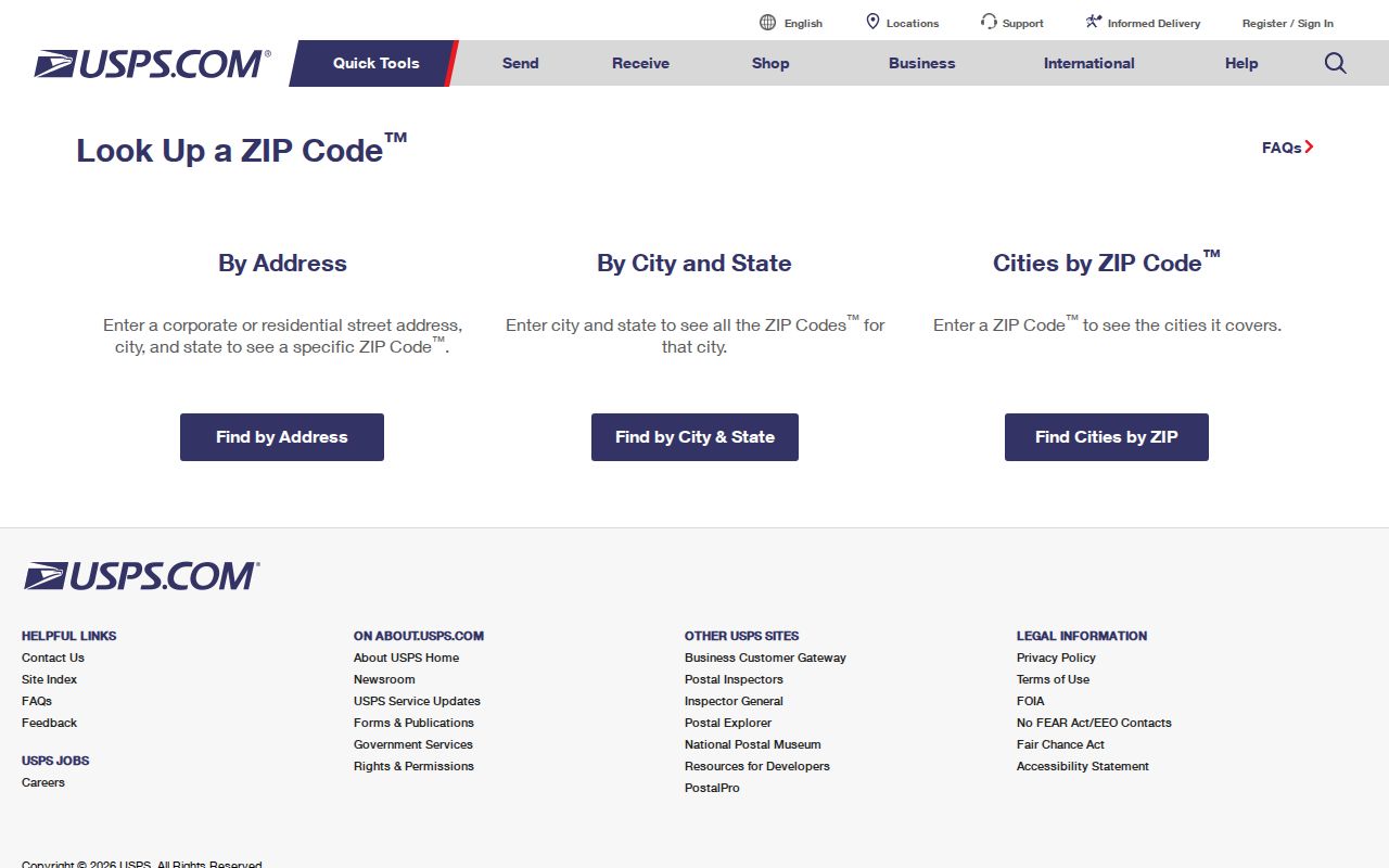
The USPS ZIP Code Lookup offers three ways to confirm postal geography. Choose the mode that matches the information in hand. Address lookup works at a street level; the city and state route returns codes tied to that mailing name; the cities-by-ZIP route starts with a code. USPS may ask for a unit number or a narrower street when several addresses match.
| USPS mode | Required entry | What it returns | Limit |
|---|---|---|---|
| ZIP Code by Address | Street address with city and state, or an address and ZIP | Postal code and standardized mailing city for the address. | Add a unit or narrow the street when results are broad. |
| ZIP Code by City and State | City and state | Codes associated with the postal place name. | A postal city name may span municipal lines. |
| Cities by ZIP | Five-digit code | Recognized city names tied to that postal code. | Does not establish a person's address or residence. |
For a visual of these options, the official USPS lookup shows the address, city-and-state, and cities-by-code routes together.
Use the returned postal city to verify mailing format, then check town jurisdiction in a local parcel or clerk record.
Connecticut ZIP Parcel and CAMA Data
Connecticut's Office of Policy and Management publishes a statewide Parcel/CAMA viewer and data collection, but the local source remains important. The records include town name and mailing fields, while parcel geometry and assessor details vary in quality by Council of Governments and municipality. A ZIP filter may find mailed parcels in a local assessment system; it does not make the results a list of everyone living in that postal area.
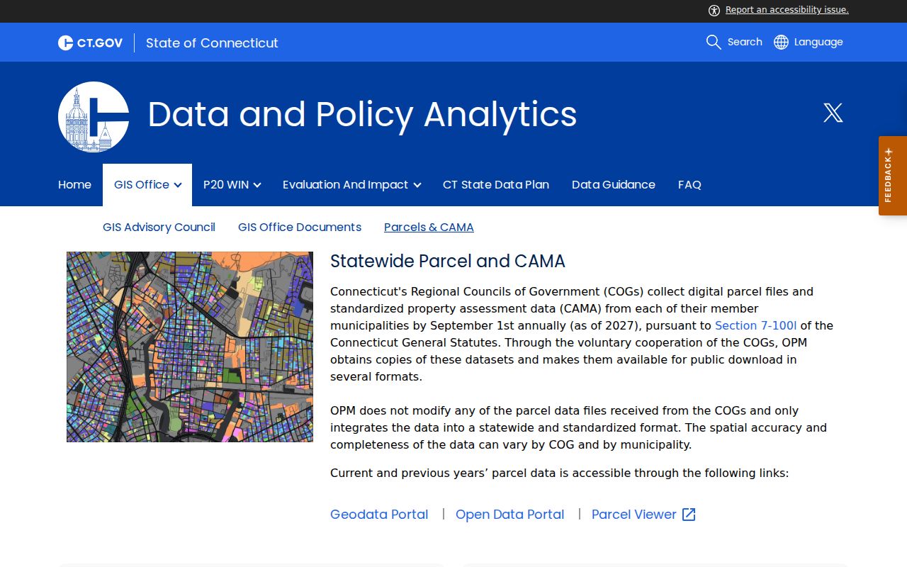
The OPM Parcel and CAMA page explains the statewide viewer and downloads. Its schema uses Parcel ID to join geometry and assessment, with Join Field, Source Name and Source Date helping identify how a local record was supplied. Use those fields to trace a parcel to its town, not to assume a statewide mailing ZIP has a single city boundary.
When the local map or assessor has no ZIP search, search by street, owner or parcel if those controls are offered. Then compare the Town Name, site address and mailing address. An assessor owner is not necessarily an occupant, and the statewide data can lag or vary in completeness. The OPM Parcel and CAMA page links to the statewide data view combining municipal information with statewide access.
Check the source date and town field before carrying a parcel result into another record system.
Connecticut ZIP Codes Inland
The 060xx and 061xx families include the Hartford region, the Farmington Valley, northern towns and government or institutional delivery in Hartford. A code beginning 060 can be tied to a village office such as Falls Village, Lakeville, Norfolk, Pine Meadow, Tariffville, West Granby, West Simsbury or Winsted. Those names are useful for finding the right post office, but Connecticut deeds and assessor files remain tied to the town that holds the parcel.
The 062xx family covers northeast communities such as Mansfield and Storrs, Danielson, Putnam, Ashford, Woodstock and village post offices including Ballouville, North Grosvenordale, Quinebaug and South Woodstock. The 063xx family reaches New London, Norwich, Groton, East Lyme and nearby coastal and eastern towns. Some recognized city names cover only part of a town or also serve a neighboring municipality. A family-level directory shows context, while USPS confirms exact delivery.
No verified statewide ZIP split or realignment history was located in the research. For a past postal change, check USPS postal bulletins or a municipal address-change record rather than infer a year from the current family grouping.
Connecticut ZIP Codes on the Coast
Families 064xx and 065xx cover much of the central shoreline, New Haven and nearby towns. The 064xx group includes towns such as Branford, Cheshire, Clinton, Guilford, Hamden, Meriden, Middletown, Milford, New Haven-area edges, North Haven, Old Saybrook, Southbury and Wallingford. The 065xx group includes New Haven and institutional or PO-box delivery, while some nearby East Haven, Hamden, North Haven and West Haven addresses use New Haven postal names.
The 066xx family centers on Bridgeport, with nearby Fairfield and Stratford delivery overlap. Families 067xx, 068xx and 069xx extend through Waterbury and the northwest, then the southwestern towns from Danbury and Norwalk to Greenwich, Stamford, Westport and Wilton. Village names such as Bantam, Cos Cob, Pawcatuck, Niantic and Storrs can be more familiar than the legal town name. Postal overlap is a cue to check the parcel or local street map, not a reason to assign the record to the larger-sounding city.
Connecticut ZIP Codes and Town Lines
ZIP areas follow delivery routes, not Connecticut's municipal borders. A property can have a recognized postal city outside the town that assesses it, or a town address can carry a neighboring place name. Hartford, New Haven, Bridgeport and Stamford all have codes for institutional, PO-box or other delivery uses as well as ordinary street delivery. Confirm the street with USPS, then confirm the legal town and parcel with the assessor or town clerk before searching a deed or municipal record.
- ZIP and ZIP+4
- The five-digit code names a delivery area; the added four digits narrow the destination to a smaller delivery segment.
- PO-box code
- A postal code assigned for delivery to post-office boxes rather than a broad set of street addresses.
- Unique code
- A code set aside for one organization, institution or other single delivery destination.
- Carrier route
- A postal delivery route within a local area. It helps sort mail and does not define a town boundary.
The municipal road map, parcel layer and town clerk index control the next step for a land record. For statewide office contacts, the Connecticut towns and cities directory can help identify the local clerk or assessor.
Connecticut ZIP Code Does Not Prove Residence
A USPS result confirms how a postal address is formatted or which place names may be used for delivery. It does not show that a named person or company is at that address. A parcel owner and a voter record answer different questions: the assessor lists property ownership and tax details, while a voter record reflects election registration and may be protected or out of date.
SOTS offers a one-person status check, not a town or postal-area roster. The full CSV costs $300 and is limited to election-related, scholarly, journalistic, political or governmental use. That file is not a bulk people search. For one person, use the status tool; for a property, use the town assessor and clerk.
Connecticut ZIP Code Record Jurisdiction
After USPS confirms the address, identify the municipality before opening a public record. Connecticut has 169 towns, cities and boroughs, and each Town or City Clerk records local land instruments. Assessor websites differ by town, as do their search fields and the completeness of statewide parcel data. A postal city can be used by addresses on both sides of a line, while a court case or vital record follows its own court or event jurisdiction.
For an existing non-exempt record, the Connecticut Freedom of Information Act allows a focused request to the agency that keeps it. It does not require an office to create a list from ZIP fields or run a custom resident search. Include a street, town, parcel or date range so staff can locate an existing record. Keep the mailing address, situs address and town name as separate facts throughout the search.
The Connecticut ZIP code directory narrows a broad area and shows where place names overlap. USPS confirms delivery; local parcel and clerk records confirm jurisdiction.